A wide variety of surface types are found over the Earth, and several models have to be used in numerical prediction systems to represent the evolution of surface processes, the turbulent exchanges of heat, water, carbon, and momentum between the surface and the atmosphere, and the land surface contribution to hydrology. The surface models in GEM and GEM-Surf are:
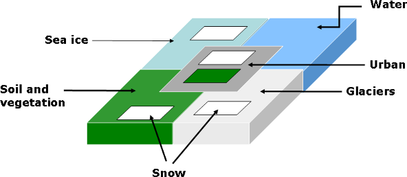
It should be noted that snow is represented using different models in several of these schemes, i.e., ISBA, SVS, CLASS, TEB, sea-ice, and glaciers. One objective in the next few years is to use the same snow model in all the surface schemes.
All these surface processes are represented in GEM and GEM-Surf. In GEM, the coupling is done in-line, in the sense that the land surface is integrated with the same computational grid and same timestep as the atmospheric model (indeed, all land surface models in this approach are part of GEM). The approach in GEM-Surf is quite different, as shown in the figure below.
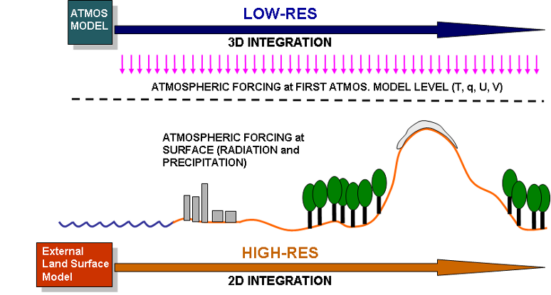
GEM-Surf only includes the surface component of GEM, and is integrated separately from GEM. This approach allows surface processes to evolve on a much higher-resolution computational grid, with a different timestep, at a reasonable computational cost. The result's quality then depends on how accurately are the land surface characteristics produced with the surface processor, and how well the atmospheric forcings represent reality (with downscaling to the high-resolution grid). GEM-Surf can run in stand-alone mode (forced by either analyses, observations, or outputs from GEM), or in a two-way coupled mode (not done yet).