Canadian Wind Atlas
[CWEA]
The main features are:
- use the global 2.5 deg NCEP 3D climatology/reanalysis;
- downscale this climatology to a mesoscale domain using WEST;
- cover Canada in a mosaic approach;
- using the WEST outputs for each tile of the mosaic,
generate a statistical database of WE;
- enable further downscaling for future more local investigations;
- provide input data for microscale models (eg WASP)
for further refinment of the Atlas.
The mosaic is based on the primary quadrangles of the National
Topographic System (NTS) of Canada. These measure 4 deg of latitude
by 8 deg of longitude; this amounts to about 440 km on a conformal
Mercator map, see Figure 1; the official NTS quadrangle identification
numbers are shown, e.g. 31 for that of Montreal. The mosaic terminates
at 64N, thus including southern Yukon.
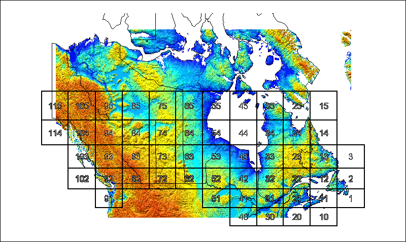
This defines Level 1 of the CWEA. Each of the
tiles is covered by a modelling mesh with a 5-km spacing.
The Level 1 Atlas is an active project of Year 2002. Click
here for preliminary results.
Level 0 of the CWEA is the non-mosaic national
map shown. It corresponds to a seamless modelling calculation
based on a 25-km spacing. Click on the map for further
details and access to its data.

Click here for further
details on the Level 0 Canadian Wind Atlas
|