|
|
Extensive Data for the Level 0 Canadian Wind Atlas
Statistical variables
| Variable |
Definition (all values in Watt/sq.meter) |
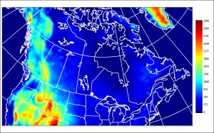
| E1 |
Time-averaged value of WE |
| E2 |
Standard deviation of WE. I.e. SquareRoot of
the Time-averaged value of (WE-E1)**2 |
| EH |
Time Frequency histogram of WE.
Values occuring in the individual intervals defined by 8 tresholds:
0., 200., 300., 400., 500., 600., 800., 1000. |
Grid description: the products are provided on
a conformal map projection. Its definition is: Polar stereographic,
true at 60N, on the spherical Earth datum, with a Earth radius
of 6371.22 km. See here for
technical aspects. The raster arrays have a size of 281 (along
x-axis) x 301 (along y-axis) points (i.e. 84300 elements). For
the GIS-type numerical data files, go here.
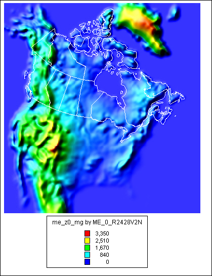
Sample
GIS analysis derived from our GIS-type files:
By importing into MapInfo, the MIF/MID file ( me_z0_mg.mif.zip
and me_z0_mg.mid.zip see further below), one can create a
thematic map of the model topography (ME variable in the file).
By selecting the relief shading option and overlaying an outline
of Canada (white line), one gets the following picture (the color
legend is included, showing elevations in meter). The visual pixels
correspond to the grid cells of 25 km.
Product
Click on small image to get the full-resolution version |
Description |
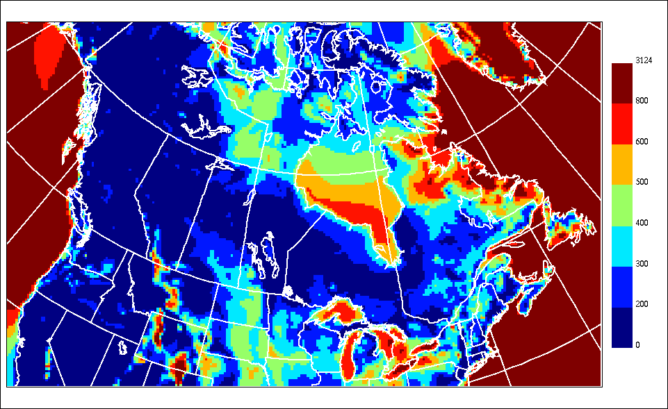
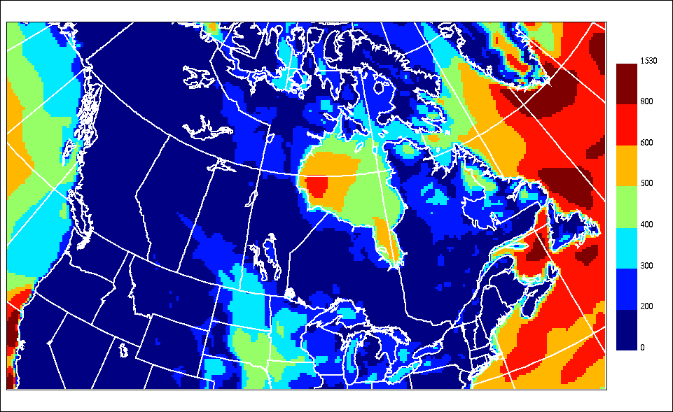
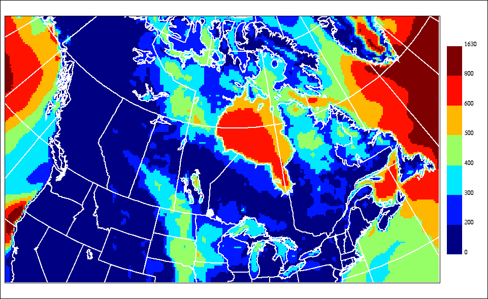
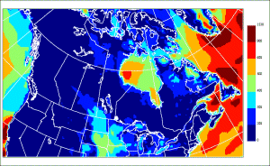
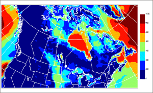
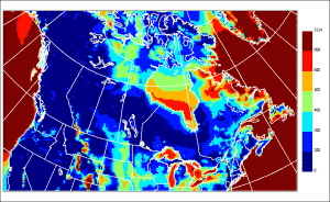 |
E1 for January |
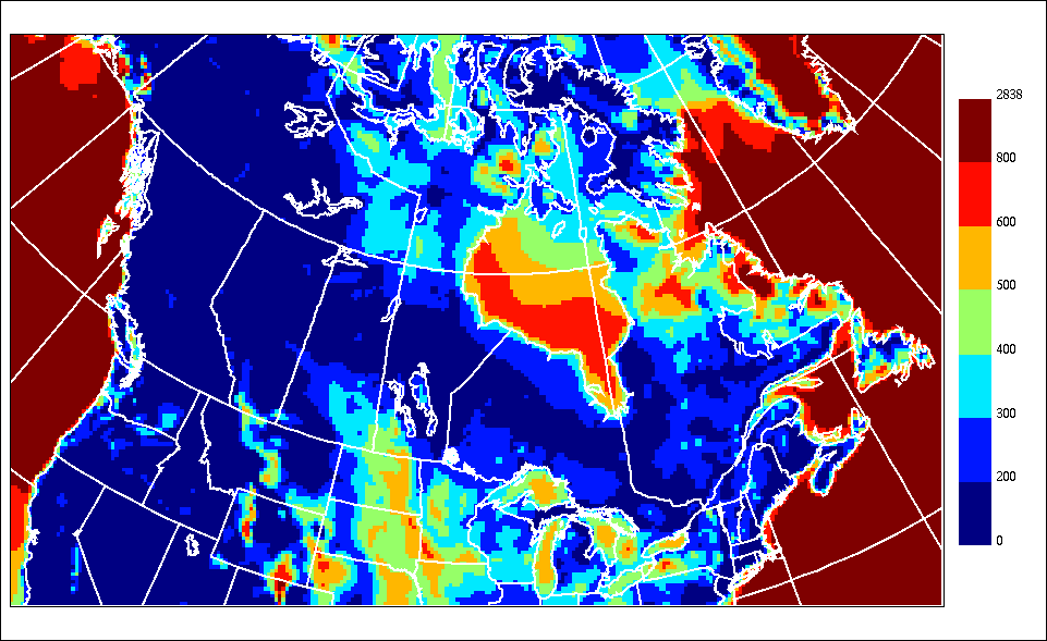
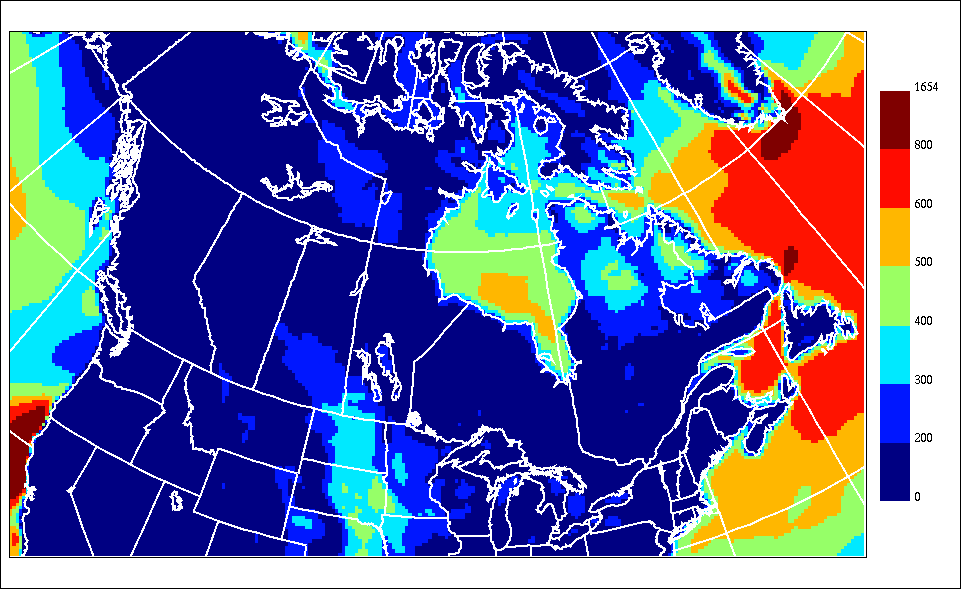
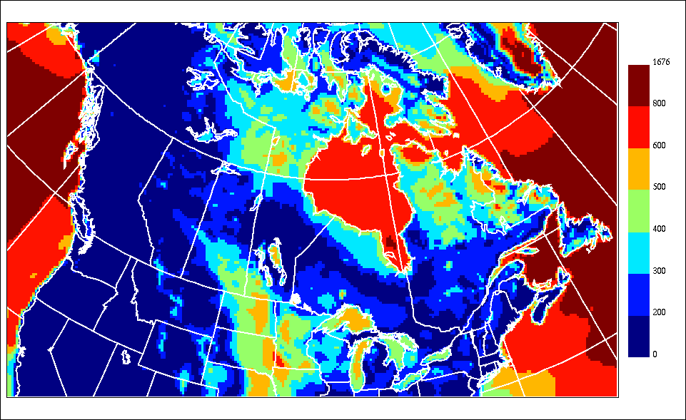
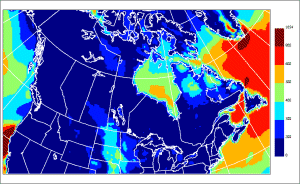
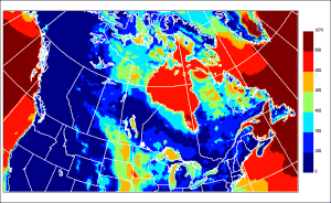
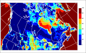 |
E1 for February |
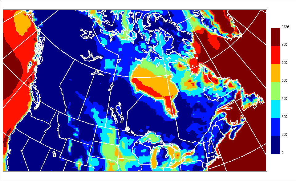
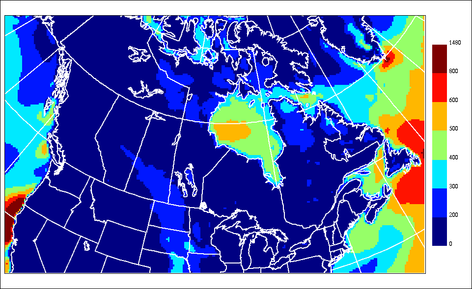
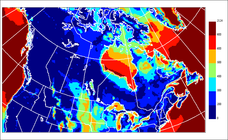
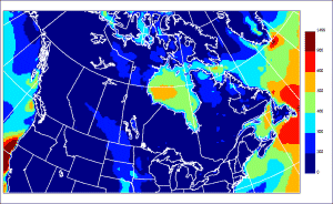
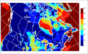
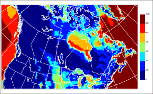 |
E1 for March |
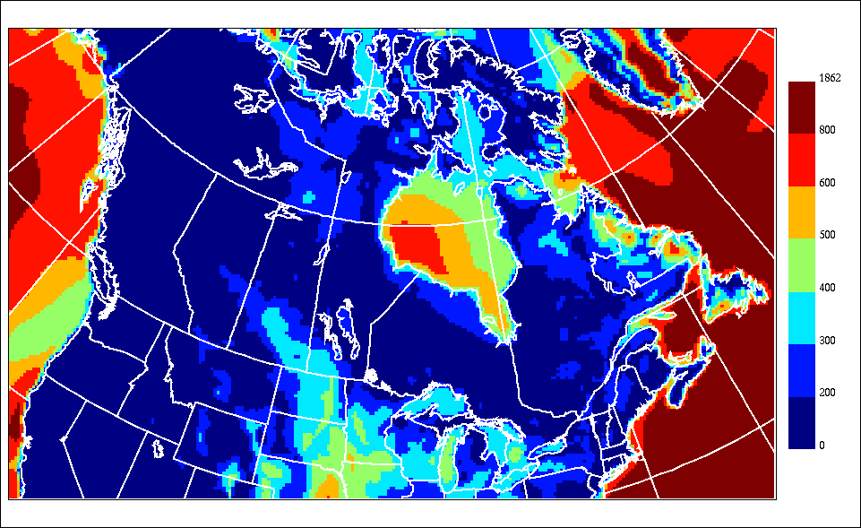
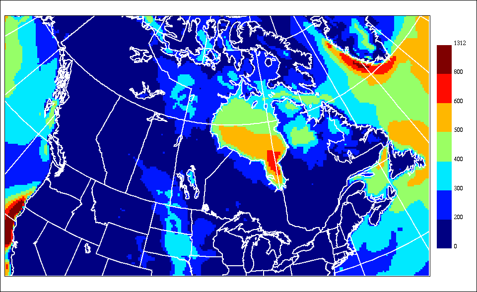
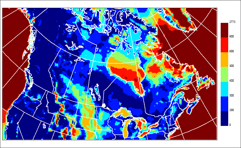
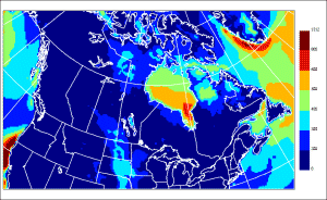
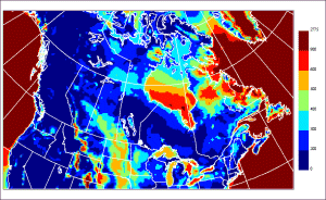
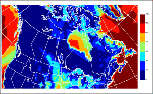 |
E1 for April |
 |
E1 for May |
 |
E1 for June |
 |
E1 for July |
 |
E1 for August |
 |
E1 for September |
 |
E1 for October |
 |
E1 for November |
 |
E1 for December |
| we.mif.zip
(695 kB) and we.mid.zip (3821
kB) |
GIS-type of files (zip-compressed) containing
all of the Total and Monthly distributions of all statistical
parameters (E1, E2, EH). These are in the MapInfo MID/MIF format.
See here for technical informations. |
 |
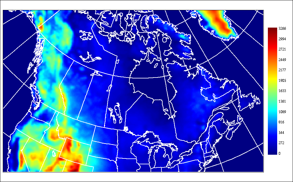
NWP model Topography (meter) |
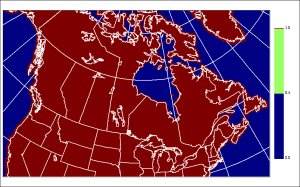 |
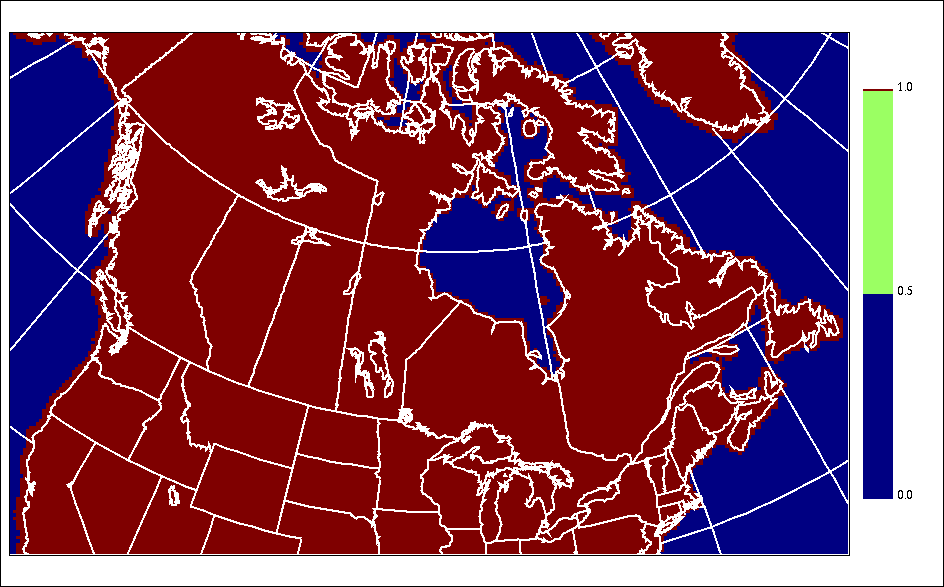
NWP model Land-sea mask (0-1). This version of
the mask does NOT delineate the lakes. However the model's mask
includes the larger lakes. |
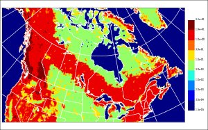 |
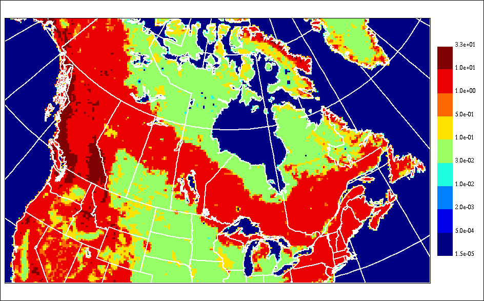
NWP model Roughness length (z0, meter) |
| me_z0_mg.mif.zip
(695 kB) and me_z0_mg.mid.zip
(227 kB) |
GIS-type of files
(zip-compressed) containing the NWP model topography, roughness
and land-sea interface. In the MapInfo MID/MIF format. See here for technical informations. |
|