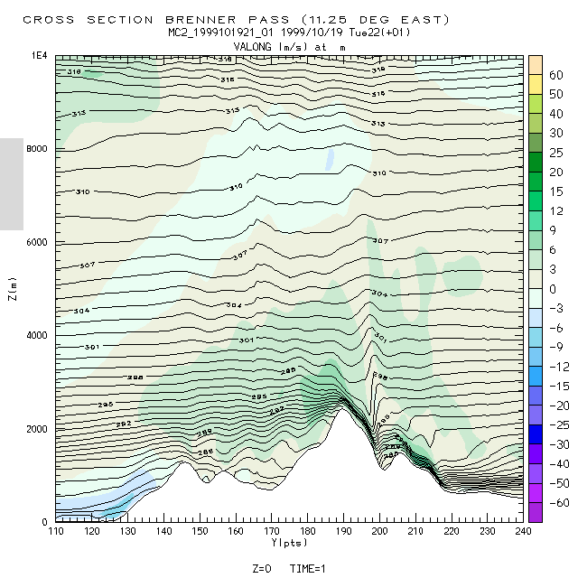
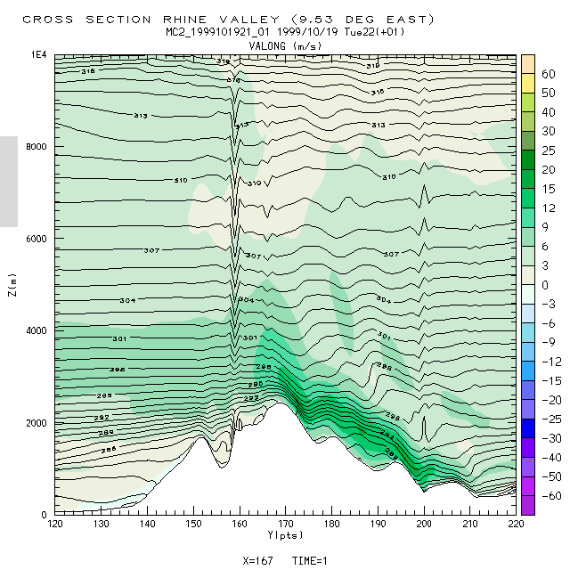
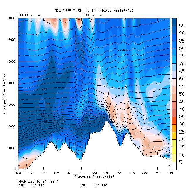
MC2 cross-sections of Föhn winds over the target areas
MC2 predicted shallow Föhn over the Wipptal which deepened through
the course of the day as the southerlies increased in strength.
This resulted in downslope winds on the northern side of the Brenner
Pass with wind speeds up to 30m/s.
The Föhn in the Rhine Valley started earlier and was somewhat
stronger, with predicted wind speeds increasing 40m/s.
|
based on MC2 forecast 991019_21
|
based on MC2 forecast 991019_21
|
for full size
click on figure |
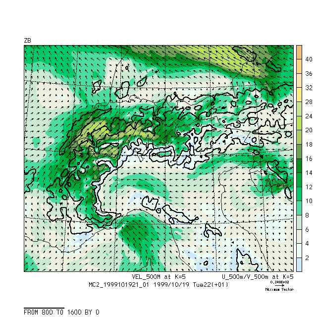
MC2 horizontal fields
The 500m wind evolution illustrates how the southerly flow to the north
of the Alps pics up during the event
as the air from higher levels decends over the ridge, while the easterlies
in the Po Valley prevailed throughout the entire day.
Maximum wind speeds 500m above the crest are about 30m/s.
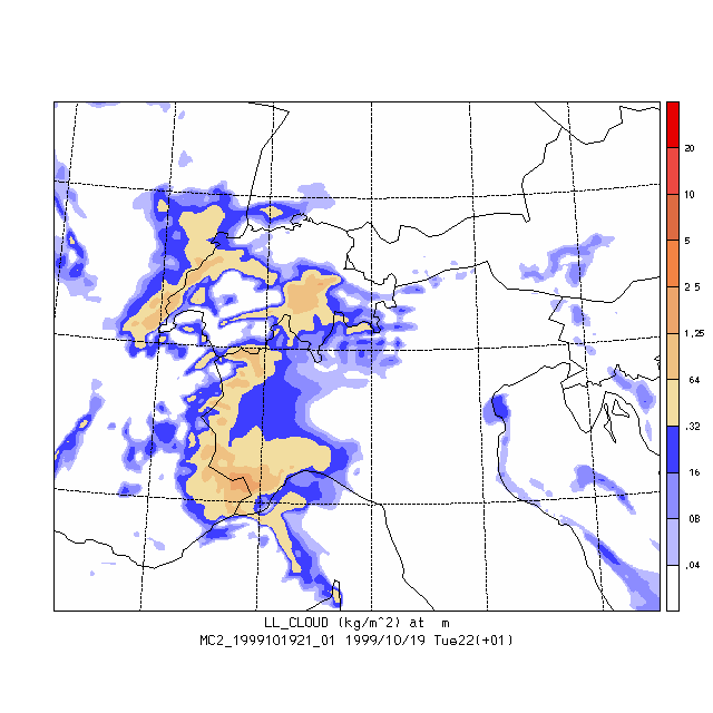
In connection with that, the cloud cover and relative humidity distribution
predicted by MC2 shows how the Föhn wall south of the ridge built
up during the day.
|
based on MC2 forecast 991019_21
|
based on MC2 forecast 991019_21
|
based on MC2 forecast 991019_21
|
for full size
click on figure |
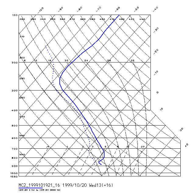
Inversions observed in Radiosoundings
The cold and humid air pool present in the Innsbruck region before it gets swept away by the Föhn onset is captured by MC2's pseudo skew-T plot.
Wind speeds observed at Patscherkofel
Photos from the flight