The operational cycle of the Canadian Meteorolo-gical Center is composed of two parallel branches. The first one performs data assimilation and medium range weather forecasting on the global scale using a global spectral model [Ritchie (1994)]. The second provides higher-resolution regional analyses and forecasts using a variable-resolution finite-element model [Mailhot (1994)]. This parallel strategy requires the maintenance, improvement and optimization of two distinct sets of libraries and procedures. The rapidly changing computing environment in the past few years has put a serious burden on the personnel responsible for accomplishing this task. The situation has initiated a thrust towards the definition of a new strategy that would consolidate these two complementary aspects of weather forecasting within a single model framework.
First, the technique is global so that the long waves are handled properly for both data assimilation and extended-range forecasting. Second, the model has a variable-resolution capability such that it is possible to use a uniform-resolution latitude/longitude mesh, or to generate a variable-resolution grid in a rotated-coordinate system with a high-resolution sub-domain that can be focused over any geographical area of interest. Outside this area, the grid spacing smoothly increases to reach its maximum value at the antipode.
The proof of concept of this strategy has been made by the development of a shallow-water prototype [Côté (1993)] that treated the horizontal aspects of the problem.
The numerical techniques used have shown a high level of robustness whether applied at uniform resolution or using the variable-resolution mesh with resolution as high as 250 meters. The formulation has recently been extended to three dimensions [Côté (1994)]. Coding of the global 3D model is complete and testing is underway.
In the present work we wish to demonstrate the flexibility of the previously-described strategy as implemented in this new global 3D model.
For the purpose of the present work, the model was run using the hydrostatic version of the model with horizontal diffusion applied on all dynamic fields.
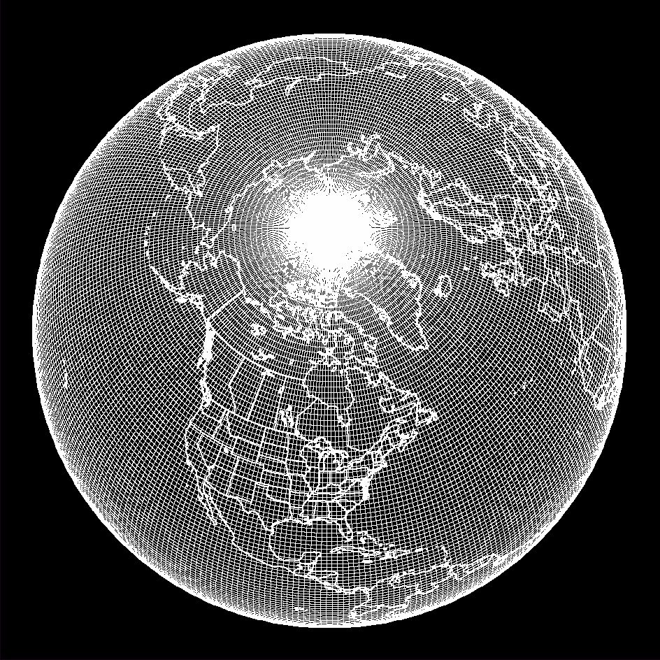
Fig 1. Uniform lat/lon mesh used for RUN 1. The resolution is approximately 1.1 deg.. The computational poles coincide with the geographical poles.
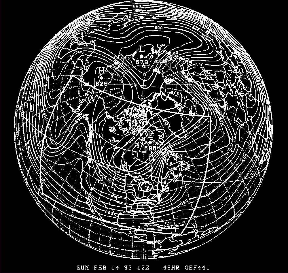
Fig. 3. 48 hour geopotential height forecast in dam for uniform-grid forecast at [[eta]]=0.43. Contour interval is 6 dam.
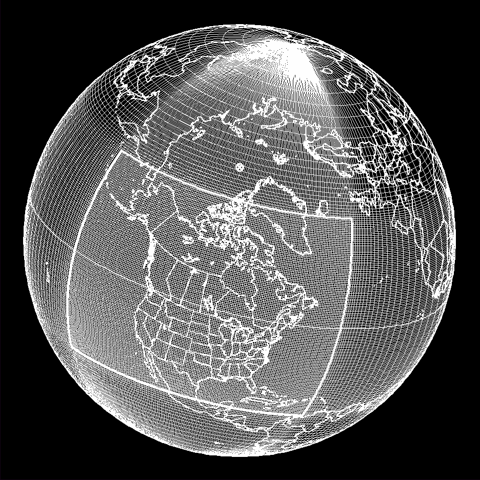
Fig 2. Rotated variable-resolution lat/lon mesh used for RUN 2. The resolution is highest at 0.5 deg. over the North American area of interest and slowly decreases away from it.
Fig. 4. As in Fig. 3, but for the 0.5 deg. variable-grid forecast.
The three runs are performed on a case of explosive cyclogenesis that starts to develop off Cape Hatteras. The integrations are initiated on February 12 1993 1200Z UTC. Since the model does not have any physical parameterization, we will not try to compare with reality. It is a good case however to put to the test the model's dynamics.
TABLE 1
                A     B          C
   RUN 1     1.1deg.  328x164  48hrs
   RUN 2     0.5deg.  225x169  48hrs
   RUN 3     0.05deg  241x225  6hrs
                .
A: Resolution in deg.
B: Number of points of the horizontal grid
C: Length of the integration
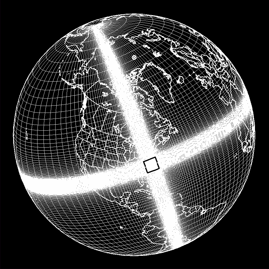
Fig 5. Rotated variable-resolution lat/lon mesh used for RUN 3. The resolution is 0.05 deg. over the area of interest covering Cape Hatteras and slowly decreases away from it.
Fig 6. 6 hour surface virtual temperature forecast in deg. K. for 0.05 deg. variable-grid model; contour interval is 2 deg. K.
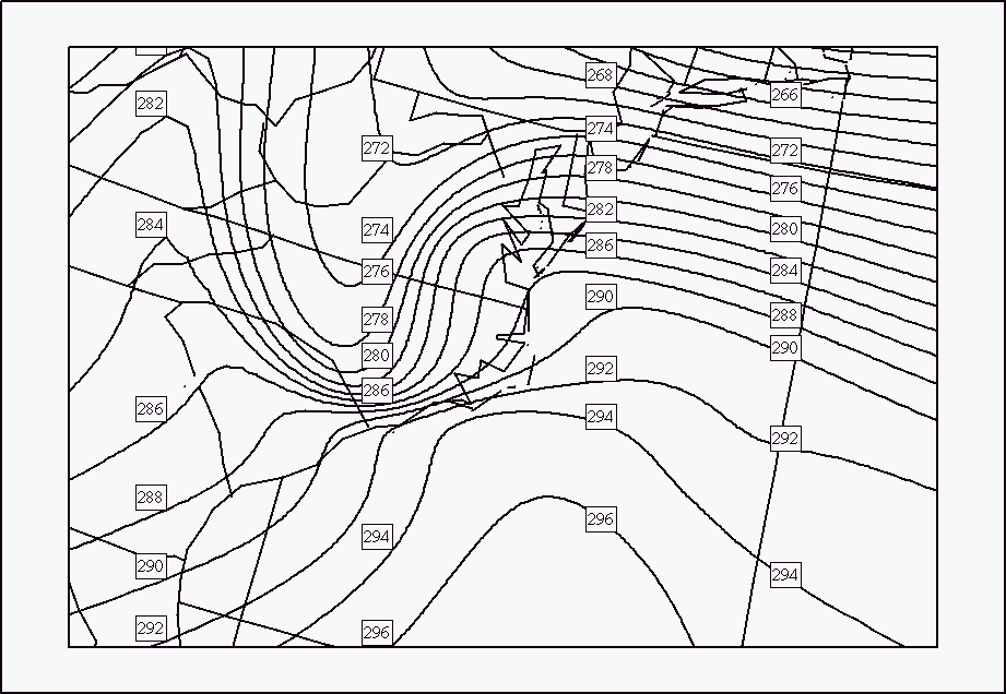
The 48 hour geopotential height forecast is presented for the uniform grid (RUN 1) in Fig. 3 and for the variable-resolution grid (RUN 2) in Fig. 4 at a model level ([[eta]]=0.43) corresponding to 430 hpa. There is quite good agreement between the two forecasts within the region of constant resolution of the RUN 2 grid. Over this region differences between the two forecasts increase close to the western boundary due to the inflow of poorly-resolved waves from the coarser-resolution outer domain. This demonstrates quite well the main objective of the variable-resolution approach, which is to maintain a high-quality forecast over an area of interest for a cost significantly less than that of an equivalent-resolution global model.
The spatial truncation errors associated with the variable-resolution portion of the model's grid progagate with the speed of the local wind. This has to be taken into account when defining a uniform-resolution region of interest for the model. It has to be sufficiently large, so that the entire region is not unduly contaminated by the error advected from the variable portion of the grid during the time of integration. It is therefore a compromise between the width of this region and the length of the run. A 6 hour surface virtual temperature forecast using the grid shown in Fig. 5 is presented in Fig. 6 (RUN 3). The developing low has triggered a sharp strengthening of the baroclinic zone to the west of Cape Hatteras, a precursor of the ensuing explosive deepening. This high-resolution model configuration, when run in non-hydrostatic mode with a complete physics package could be a good tool to study successive stages of explosive cyclogenesis in research mode or to proceed to nowcasting at the meso-[[gamma]] scale in the operational mode.
The preliminary results shown in the present work are encouraging. The strategy that was developed in a 2D prototype and recently extended to 3D shows promising results in our progress towards a unified data assimilation and forecast system at the heart of which lies a single multipurpose and multiscale numerical model.
Côté, J., S. Gravel, M. Roch, A. Patoine and A. Staniforth, 1994: A non-hydrostatic variable-resolution global model of the atmosphere Preprints 10th Conf. on Num. Wea. Pred., Portland, 171-172.
Laprise, R., 1992: The Euler equations of motion with hydrostatic pressure as independent variable. Mon. Wea. Rev., 120, 197-207.
Mailhot, J., R. Sarrazin, B. Bilodeau, N. Brunet, A. Methot, G. Pellerin, C. Chouinard, L. Garand, C. Girard and R. Hogue:, 1995: Changes to the Canadian regional forecast system - description and evaluation of the 50 km version. Atmos.-Ocean, 35, 1-28.
Ritchie, H. and C. Beaudoin, 1994: Approximations and sensitivity experiments with a baroclinic semi-Lagrangian spectral model. Mon. Wea. Rev., 122, 2391-2399.